

40m HF band opening – Animated view
On account of the above phenomena, the plasma density of the ionospheric layers above the earth also continuously alters their characteristics in terms of their charge densities, thickness, and height. During the night, the D-layer dissipates while the E-layer practically disappears due to excessive thinning of its plasma density. The F1 and F2 layers combine into one and also move to an elevated altitude. Check out the article Ionospheric Skywave Propagation for more information. As a consequence, the physical phenomena of refraction that is responsible for skip propagation also change its behavior. The net result leads to what we, the radio amateurs, perceive as constantly altering propagation behavior on HF bands over time.
All of us, the HF radio operators, experience all these propagation variations and various other idiosyncrasies of mother nature. It is so very fascinating… However, it is one thing to experience the phenomena while in QSO on the HF radio, it is quite another thing to get a bird’s eye view and picturise the effects on a map as they unfurl over time as the daylight conditions change.
Several months ago, at the behest of a radio friend from Columbia, I set out to do some propagation modeling on the 40m HF band with his QTH in Columbia as the reference point. We were trying to validate a few observations that had been made on-air. I ended up with a pretty accurate set of propagation projections, all data related to which was transformed into map-based graphical projections. I am sharing the combined graphical rendition of what we recorded and projected using my propagation model.
40m HF Band Animated Rendition of Dynamic Propagation Shift
I captured this fascinating graphical view of the changing HF propagation conditions on the 40m HF band and turned it into an animation for those who might be interested. This is centered around the QTH in Columbia. It is the 40m HF band propagation scenario as it existed on 19th December between 19:00 UTC to 01:00 UTC. As you might observe, our animated graphical rendering starts with a very limited local coverage and gradually goes on to expand into a grand DX opening all around…
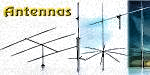
The animation captures scenarios at 15-minute step intervals. The antennas used for this simulation are 3-el Yagis on both TX as well as RX…
Those who might like to understand the phenomena as they watch the animation are requested to observe the finer points. For instance, watch the E-W shift in the position of the Sun around its latitude position of approximately 23.4 deg South. Also, observe the shift of the Gray-line along with the shift of the solar footprint location as Columbia goes from daylight to darkness while the 40m propagation opens up and spreads like the opening of a fist across the Atlantic into the EU and subsequently into North and South America… Absolutely breathtaking, isn’t it? .. Enjoy the spectacular view provided by the animation.
An animated rendering of the unfolding of a 40m HF band propagation opening scenario at a location in Columbia, south America as the region graually moves into the sunset and eventually the night. The declination of the sun determines the slope of the Day/Night Terminator (Gray-Line) that creates the twilight zone transition.
With the passage of time, as the sun in the sky appears to move westwards, the sun begins to set in South America too. At the start of the animation, the Day/Night Terminator line (also called the Gray-Line) that defines the twilight zone is seen to be cutting across obliquely along a narrow sinusoidal zone on the map. Initially the Gray-Line is seen to pass through the North Atlantic and the west coast of Africa. At this time it is evening in South America. The 40m range coverage from our location in Columbia is quite limited.
As time goes by, the sun moves further west and the Gray-Line also shifts proportionately westward. South America gradually heads into the sunset which eventually engulfs Columbia. During this transition period, the ionospheric skip in the direction of the Gray-Line region starts becoming more and more robust. This is on account of a gradual reduction in the densities of ionospheric plasma across all layers. In the zone, that is already past sunset, the D, and E layers would have rapidly dissipated while also reducing the combined F-layer plasma density. As the result of all these factors, the propagation attenuation of the 40m RF signal into the night-time region reduces considerably, thus allowing a wider propagation range for communication.
Similar phenomena based on the above factors also unfold as North America slips into the night. As this happens, the propagation on the 40m HF band also gradually opens up into North America.


(3 votes, Rating: 5.00) - Please vote the article with your valuable star rating. Thanks! Basu (VU2NSB)


Ham Rig Reviews Coming Soon
SSN SSNf(10.7) – Real-time Solar Data


